The Place
The History of Myers Park
A cotton farm, a banker, a planner who refused the grid, and a hundred years of trees. This is how Charlotte's most storied neighborhood came to exist.
Reviewed · Discover Myers Park editorial desk
The 1911 Plan
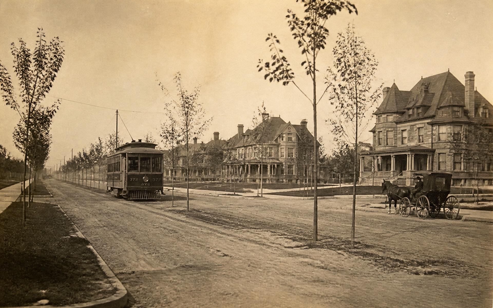
Charlotte at the turn of the twentieth century was a mill town with ambitions. Cotton money and, increasingly, banking money were accumulating faster than the city's housing stock could absorb, and the fashionable answer everywhere in America was the same: a planned residential suburb connected to downtown by streetcar.
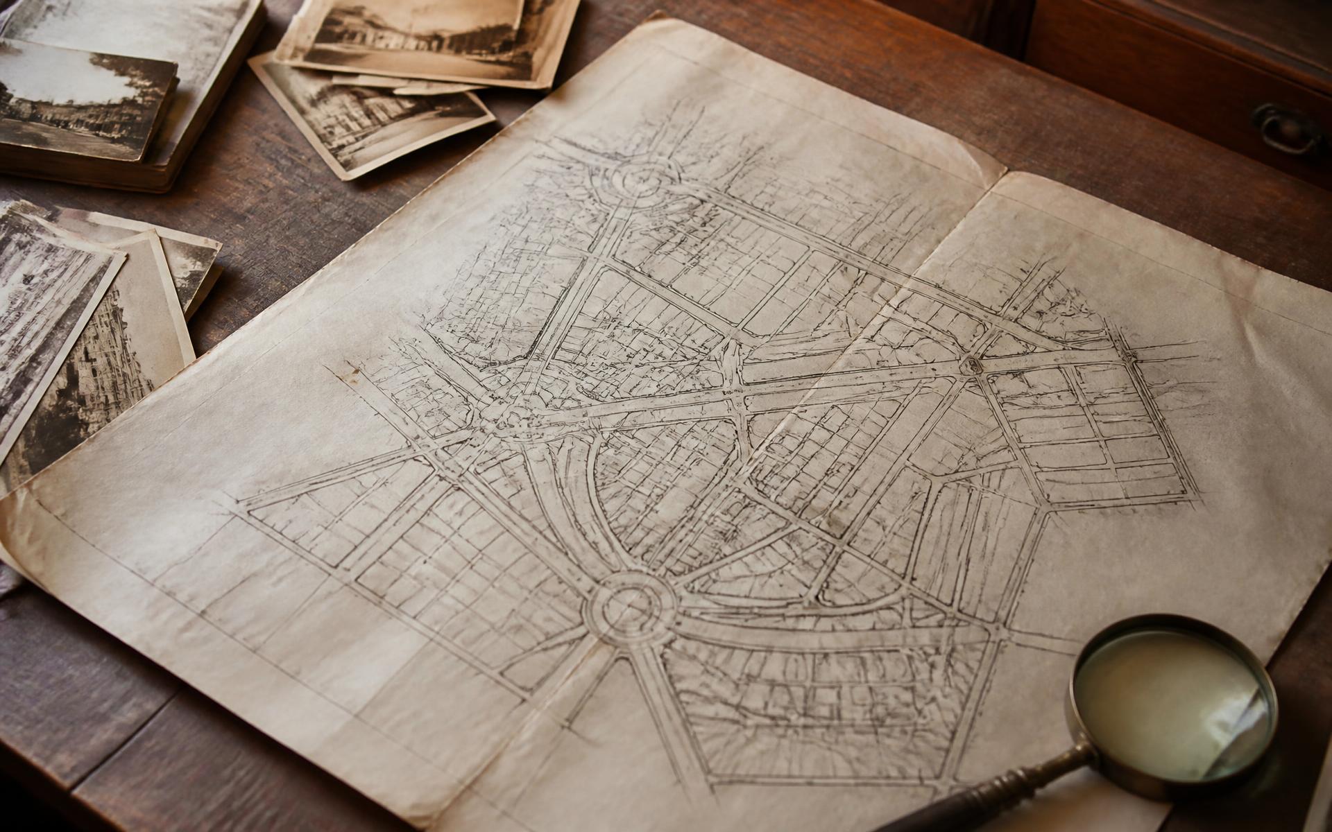
George Stephens, a Charlotte banker who had already developed Piedmont Park, married into the Myers family and in 1911 acquired roughly eleven hundred acres of his father-in-law's cotton farm southeast of the city. What distinguishes what happened next from a hundred similar ventures is that Stephens hired properly. He brought in John Nolen, a Harvard-trained landscape architect then at the beginning of a career that would produce more than four hundred plans across the country.
Nolen refused the grid
The conventional approach was to survey a rectangular grid, subdivide it into equal lots, and sell. Nolen did the opposite. He walked the land, mapped its drainage and ridges, and drew streets that curved with the topography — Queens Road looping out from the city, Queens Road West splitting away, Hermitage and Cherokee threading between them. Lots were irregular by design. Houses were set well back. Rights-of-way were made wide enough for planted medians and generous verges.
Crucially, Nolen specified the trees. Willow oaks — fast-growing, high-branching, and tolerant of Piedmont clay — were planted along the streets as the neighborhood was built. Nobody who bought a lot in 1913 saw the canopy. It was a fifty-year bet, and it paid.
Chronology
A century in nine moments
- 1911
George Stephens acquires the Myers family cotton farm and hires John Nolen.
- 1912
The first Myers Park lots are offered; Queens Road is graded along the streetcar route.
- 1915
The Duke Mansion is completed on Hermitage Road — later home to James B. Duke.
- 1921
Myers Park Country Club opens with a Donald Ross golf course at the neighborhood's heart.
- 1920s
The Georgian Revival and Tudor building boom fills Queens Road, Cherokee, and Hermitage.
- 1938
Charlotte's streetcars stop running; the curved street plan they created remains.
- 1950s
The willow oaks planted forty years earlier close overhead. The canopy becomes the neighborhood's signature.
- 1980s
Local historic district protections and landmark designations begin covering portions of the neighborhood.
- 1990s–now
Sustained tear-down and rebuild pressure makes canopy protection and design review permanent local issues.
The Plan's Lasting Consequences
The streetcar stopped running in 1938, but the plan it produced outlived it and arguably improved with the car. Curved streets discourage speed. Deep setbacks give the canopy room. The absence of a grid means there is no efficient route through Myers Park, which is why through-traffic largely goes around it.
Myers Park is widely regarded as one of the best-preserved Nolen residential plans in the United States.
The neighborhood's more recent history is a story of pressure. From the 1990s onward, rising land values made the arithmetic of tear-down-and-rebuild irresistible on smaller houses, and the resulting fights — over scale, over setbacks, and above all over trees — produced the tree ordinance and design-review framework that governs building here today. Anyone planning work should read The Tree Canopy and Renovating a Historic Home before drawing anything.
Questions
Frequently asked
Development began in 1911, when George Stephens acquired roughly 1,100 acres of the Myers family cotton farm and commissioned the landscape architect John Nolen to plan a residential suburb. The first lots sold in 1912, and the streetcar extension that made the neighborhood viable opened the same period.
John Nolen was among the most influential American city planners of the early twentieth century, with more than four hundred projects to his name. Myers Park is considered one of his most intact residential plans — curvilinear streets following topography, generous setbacks, planted rights-of-way, and parkland woven through rather than appended.
The land belonged to John Springs Myers, a Mecklenburg County cotton farmer. His son-in-law George Stephens, a Charlotte banker and developer, bought the farm and named the new suburb for the family. The Myers name persists across the neighborhood, the high school, and the country club.
Yes. The neighborhood was laid out on the assumption that residents would ride the streetcar into Charlotte rather than drive. The line ran out Queens Road, which is why that street is the neighborhood's spine and why the earliest and grandest houses cluster along it. The streetcars stopped running in 1938; the street pattern they produced remains.
Nolen specified street trees as part of the original plan, with plantings beginning in the 1910s and continuing through the neighborhood's build-out. Willow oaks were chosen for their fast growth and high, arching habit. The canopy people photograph today is the result of more than a century of growth and deliberate replacement.
Physically, less than almost any comparable American neighborhood — the street plan is intact and the canopy has been maintained. What has changed is the housing stock: smaller early houses have been expanded or replaced, and tear-down-and-rebuild activity has been steady since the 1990s, which is precisely why canopy protection and historic review became contentious local issues.
Continue reading
- Read →
Architecture of Myers Park
Georgian Revival, Tudor, Colonial Revival, and the modern houses that earned their place among them.
- Read →
Myers Park Historic Homes
Old, historic, and designated are three different things. What each one means for a house here.
- Read →
Queens Road West
The most photographed street in Charlotte: its willow oak cathedral, its houses, and its rules.
- Read →
The Tree Canopy
Why the willow oaks exist, who protects them, and what that means if you own one.